Planetary maps and de-rotation with WinJUPOS
Check out the new site at https://rkblog.dev.
27 August 2010
Comments
WinJUPOS is a free application for processing and analyzing planetary images. It can do many things but I'll describe the most interesting features: map making and removing planet rotation from AVIs and RGB, LRGB images.
Image measurements
Start the program and choose a planet you want to process from the main menu. Then you can start by "describing" each of your images. Every planetary image needs to have a measurement - IMS file made by WinJUPOS. This is needed to make a map, de-rotate an AVI or make de-rotated LRGB, RGB images. Open Recording -> Image measurement:


I use Castrator to crop the AVI and center the planet. This is quite effiecient at aligning channels vs each other. In WinJUPOS I try to make an automatic good overlay on blue or green channel image (seems to work best) and then keep it for every other image. If that produces misaligned color images then I play with the outlines for every image.
De-rotation of R/G/B frames - making LRGB/RGB images
WinJUPOS can make RGB or LRGB images out of monochrome channels. It makes the color image and also de-rotates the planet in channels to identical rotation state. To do so open Tools -> De-rotation of R/G/B frames: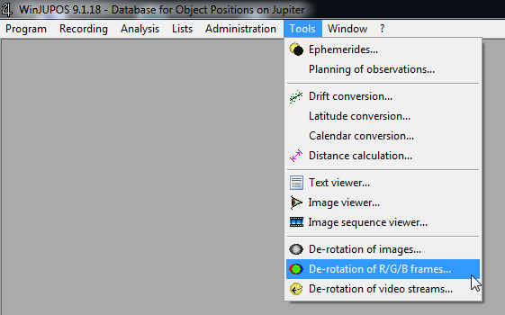


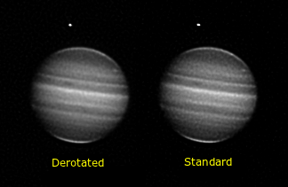
De-rotation of video streams - de-rotating frames in an AVI
This is a new feature - derotating frames in an AVI so that planet rotation won't blur features during stacking. It needs the AVI, a measurement of a processed image (stacked as normal) and time - start and end time of the recording. Apps like FireCapture save "start at" and duration informations in text files associated with the AVI files...
Open De-rotation of video streams from Tools:
- Select the AVI file
- Then enter start and end time of the recording (note: for some reason the end time may change sometimes on its own - if it does - put the correct time back again)
- Select image measurement of the stacked image
- Choose "Corrected Video" option
- Start the derotation
Planetary maps
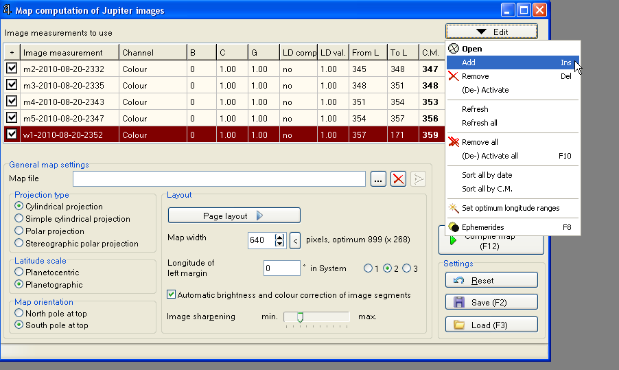
If you have one or more images take at different time - showing as the planet rotates you can create a map. You need the measurements for each image, then you can open Analysis -> Map computation:

RkBlog
Check out the new site at https://rkblog.dev.


Comment article